Our Research
As climate changes, how do Earth's frozen areas affect our planet and impact society?
In this section
Related News & Stories
Filter by:

Feature Story
The Arctic Rain on Snow Study (AROSS) project, led by the National Snow and Ice Data Center (NSIDC), funded an award-winning StoryMap called "When Rains Fell in Winter," which tells the story of a Nenets reindeer herder named Tokcha Khudi and how a catastrophic rain-on-snow event impacted his annual migration on the Yamal Peninsula in 2013.
News Release
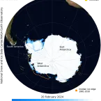
Antarctic sea ice has likely reached its minimum extent for the year, at 1.99 million square kilometers (768,000 square miles) on February 20, 2024, according to scientists at the National Snow and Ice Data Center (NSIDC) at the University of Colorado Boulder. The 2024 minimum is tied with 2022 for second lowest in the 46-year satellite record. The record low occurred last year, with the ice reaching 1.79 million square kilometers (691,000 square miles) on February 21, 2023.

Ice Sheet Analysis
Ice sheet surface melt on the Antarctic Peninsula abruptly dropped in mid-January and remained low through February 15. By contrast, melt day totals for the season were above average for the northern Larsen C and George VI Ice Shelves.

Ice Sheet Analysis
With the melt season well underway in the Southern Hemisphere, several ice shelves extending from the Antarctic Ice Sheet show above average melting, with significant melting in the Antarctic Peninsula region.
Spotlight
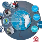
QGreenland is a free mapping tool supported by video tutorials, complete documentation, and a website to help you to get started and continue your learning. The project now boasts a new product release, a revamped website, and funding for enhanced data sharing and interoperability.
Ice Sheet Analysis
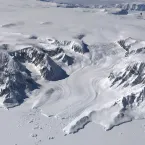
As of December 15, the Antarctic Ice Sheet had above average melt in the Amery and Dronning Maud Land Ice Shelf regions, with significant melting on the Antarctic Peninsula. Greenland’s 2023 melt season was the third highest on record.